The Southern section of the Stratford-upon-Avon Canal has three aqueducts of which the Yarningale is the first (if you are heading to Stratford from the North, or the last if the other direction of course!)
The very short Yarningale Aqueduct spans the Kingswood Brook near Claverdon and dates from the early 19th century. Yarningale itself is a hamlet of the Claverdon parish.
The original aqueduct was made of wood but it was washed away in 1834 during the flooding of the canal and the nearby Grand Union Canal. A new aqueduct was made from cast iron at Horseley Ironworks and this is the structure that remains today. Like the Edstone and Wootton Wawen aqueducts further down the Stratford canal the Yarningale Aqueduct is unusual in that the bottom of the towpath is level with the bottom of the canal.
Sunday 28 January 2018
Monday 22 January 2018
Soho Loop
The original Birmingham Main Line stretched from over 36km from Aldersley Junction (Staffordshire and Worcestershire Canal) to the centre of Birmingham. The canal opened to traffic in 1769 and was fully open in 1772. However the original line was long and winding as it followed the contours of the land with a number of deviations to give access to the many industries in the area. This was creating bottlenecks along the route.
A much straighter New Main Line was built in the 1820s, opening in 1827. Much of the original main line was kept especially where it gave access to industry, some of the old loops becoming branches of the new main line including the Soho Loop.
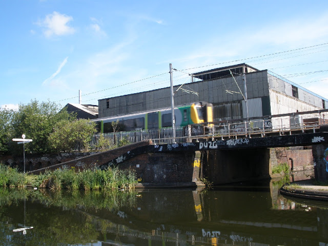
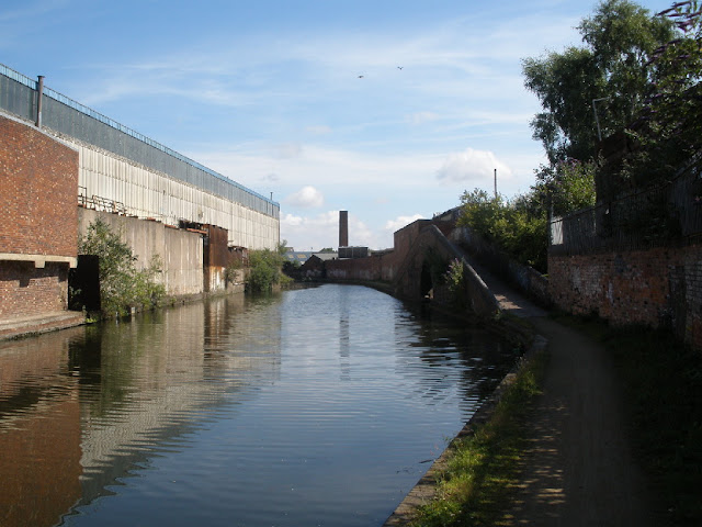
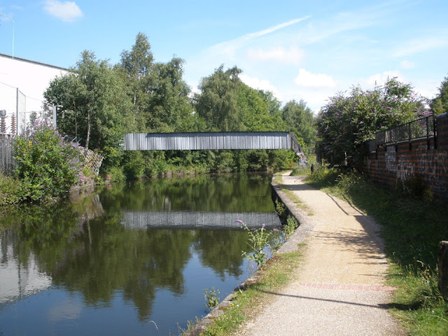
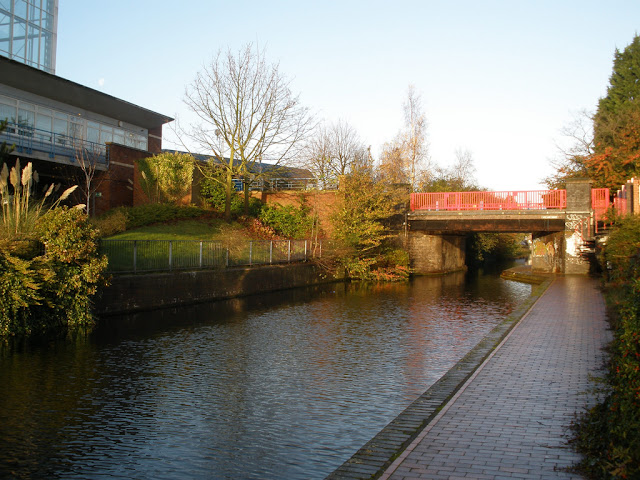
The Soho Loop is a 2km section of canal which once had a branch which served Matthew Bolton's Soho Manufactory. The remnant of the Soho Branch is now private moorings. A notable location the Soho Loop passes is Winson Green prison and also Soho railway depot.
 |
| Rotton Park Junction, the Soho Loop begins under the bridge |
 |
| Soho Loop |
 |
| A pipe bridge |
 |
| Winson Green junction, the Main Line is beyond |
 |
| The Soho Branch |
Tuesday 16 January 2018
Digbeth Branch Canal
The Digbeth Branch Canal was built in 1799. It is a short stretch of waterway that links the Grand Union Canal at Bordesley Junction to the Birmingham and Fazeley Canal at Aston Junction and hence enables boats on the Grand Union to go through into the city centre. The canal was built as part of the Birmingham Canal Act of 1768.
Although only 2.4 km/1.5 miles long the canal is certainly not lacking for features. It has two tunnels, the Ashted and Curzon Street tunnels - the latter carries several of the approach railway lines including the West Coast Main Line into Birmingham New Street over the canal. There are also a number of locks and bridges, plus a wharf and a basin! Its not the most scenic of canal walks it has to be said.
Originally the canal only stretched as far as the Warwick Bar where a stop lock was installed to stop water leaking between the Birmingham Canal Navigations and what became the Grand Union. However these days the canal is counted as continuing onto Bordesley (or Digbeth) Junction.
| Information | |
|---|---|
| Opened: | 1799 |
| Route: | Aston-Bordesley, Birmingham |
| Distance: | 2.4km |
| Status: | Complete |
Originally the canal only stretched as far as the Warwick Bar where a stop lock was installed to stop water leaking between the Birmingham Canal Navigations and what became the Grand Union. However these days the canal is counted as continuing onto Bordesley (or Digbeth) Junction.
 |
| Aston Junction |
 |
| BCU's new campus now dominates the skyline behind this lock |
 |
| Inside Ashted Tunnel |
 |
| Travelling through Aston Science Park |
Monday 15 January 2018
Berwood Bridge
Berwood Bridge of the Birmingham and Fazeley Canal is one of the Listed Buildings in Erdington and one of the last remaining traces of the Berwood sub-manor of Erdington.
Berwood Hall, which once stood where the modern day Farnborough Road is now, dates from the 13th century. The land originally, it is recorded, was given by Hugh de Arderne [1] to the Abbey of St Mary of the Meadows in Leicester for use of a monastic grange. A moated hall is recorded in the 13th century but by the 17th century it had fallen in disrepair. A chapel on the manor (built by the canons in return for the gifts of land to sing masses for the souls of Hugh's descendants) fell into disuse by the early 15th century. The manor remained the possession of the abbey until the dissolution of the monastries and the manor was sold to Thomas Arden in 1540.
It remained owned by the Ardens until a later descendant (Dorothy) married into the Bagot family of Staffordshire [2]. The Reverend Walter Bagot was lord of the manor in 1783, his son was also later lord of the manor at nearby Pype Hayes Hall. The Bagot Arms pub still bears their name.
Much of the land was sold in the 1880s by the Bagots to the Birmingham Tame and Rae Drainage Board (a sewage farm is listed as being here in the late 1800s before it was moved to its current location in Minworth) but by then the manor probably no longer existed in any real sense.
A farmhouse built on the site of the former manor house served as the officers' mess at Castle Bromwich Aerodrome during the First World War [3] though by the Second World War the farmhouse and much of the rest of the Berwood estate had been swallowed up by the airfield. Following the war the Castle Vale estate was built on the site of the old airfield.
A few names survive here and then on new buildings and roads but it is likely the only surviving remnant of the old manor is Berwood Bridge which was built at the end of the 18th century or early 19th to allow Berwood Lane to cross the then-new Birmingham and Fazeley Canal.
[1] L. F. Salzman (editor). "Parishes: Curdworth." A History of the County of Warwick: Volume 4: Hemlingford Hundred (1947): 60-67. British History Online. Web. 26 March 2012. http://www.british-history.ac.uk/report.aspx?compid=42656&strquery=berwood
[2] William Fowler. "A history of Erdington: an address to the members of the Erdington Institute... delivered April 27th, 1885 (London:British Library)"
[3] William Dargue. "A History of Birmingham Places & Placenames . . . from A to Y" Berwood, Berwood Common http://billdargue.jimdo.com/placenames-gazetteer-a-to-y/places-b/berwood/
 |
| Berwood Bridge |
Berwood Hall, which once stood where the modern day Farnborough Road is now, dates from the 13th century. The land originally, it is recorded, was given by Hugh de Arderne [1] to the Abbey of St Mary of the Meadows in Leicester for use of a monastic grange. A moated hall is recorded in the 13th century but by the 17th century it had fallen in disrepair. A chapel on the manor (built by the canons in return for the gifts of land to sing masses for the souls of Hugh's descendants) fell into disuse by the early 15th century. The manor remained the possession of the abbey until the dissolution of the monastries and the manor was sold to Thomas Arden in 1540.
It remained owned by the Ardens until a later descendant (Dorothy) married into the Bagot family of Staffordshire [2]. The Reverend Walter Bagot was lord of the manor in 1783, his son was also later lord of the manor at nearby Pype Hayes Hall. The Bagot Arms pub still bears their name.
Much of the land was sold in the 1880s by the Bagots to the Birmingham Tame and Rae Drainage Board (a sewage farm is listed as being here in the late 1800s before it was moved to its current location in Minworth) but by then the manor probably no longer existed in any real sense.
 |
| December 1945 view of Berwood Bridge (via Google Earth), the bridge can be seen just left of the centre of the image. |
A few names survive here and then on new buildings and roads but it is likely the only surviving remnant of the old manor is Berwood Bridge which was built at the end of the 18th century or early 19th to allow Berwood Lane to cross the then-new Birmingham and Fazeley Canal.
[1] L. F. Salzman (editor). "Parishes: Curdworth." A History of the County of Warwick: Volume 4: Hemlingford Hundred (1947): 60-67. British History Online. Web. 26 March 2012. http://www.british-history.ac.uk/report.aspx?compid=42656&strquery=berwood
[2] William Fowler. "A history of Erdington: an address to the members of the Erdington Institute... delivered April 27th, 1885 (London:British Library)"
[3] William Dargue. "A History of Birmingham Places & Placenames . . . from A to Y" Berwood, Berwood Common http://billdargue.jimdo.com/placenames-gazetteer-a-to-y/places-b/berwood/
Thursday 11 January 2018
Travelling the Grand Union Canal in the 1930s
An amazing video following showing canal boats travelling from London up to Birmingham in the 1930s. Showing inland waterway traffic on the Thames, Regent's Canal and Grand Union Canal. Some things of course look very different now but some things are unchanged, though you may need to look closely sometimes!
Labels:
Grand Union Canal,
Video
Monday 8 January 2018
Circular spill weir
Spill or overflow weirs are pretty common on the canal network, they help manage water levels by providing an "escape" for overflow water if the water level gets too high. Much rarer though are circular spill weirs, several still remain on the Cotswold Canals such as the one shown below at Ebley Wharf on the Stroudwater Navigation.
With a circular spill weir water from the canal rises up in the outer ring and when it reaches a certain level overflows into the central hole. The water then is carried away through a culvert. In the case with the weir here to the river Froome.
With a circular spill weir water from the canal rises up in the outer ring and when it reaches a certain level overflows into the central hole. The water then is carried away through a culvert. In the case with the weir here to the river Froome.
Wednesday 3 January 2018
The London & Birmingham Canal
Looking at a modern canal map you might wonder why Birmingham and Coventry are not linked directly by a canal. You can get from city to city but only by a round-about way using the Birmingham and Fazeley and Coventry Canals. However in 1828 there indeed was a proposal which could have directly linked the two cities.
The proposed London and Birmingham Canal was an attempt to shorten the distance between the two cities. It was a proposed link from the Oxford Canal at Brinklow, passing through Coventry and then linking up to the Stratford Canal. According to a map of the proposed route [1], the canal would have been 18 miles /29 km long and as well as being a shorter distance for freight to travel between the two cities would also have reduced the number of locks that needed to be travelled through from 51 to 15.
This was an important consideration as the existing canal network was not designed with trade between Birmingham and Staffordshire to London in mind [2]. The number of locks that needed to be navigated through, especially at the already overloaded Farmer's Bridge Locks between Birmingham city centre and Aston [3], was considered an impediment in trade and progress and could be greatly reduced by the new canal [4]. The new canal could also be the same width as the Grand Junction Canal to allow more goods. In theory larger barges would be possible too though the narrower Stratford (and other Birmingham Canal Navigation) canals meant that the larger barges would not have got through to the big city.
The map unfortunately does not say exactly where the new canal would have joined the Stratford however it would have linked up to the canal at it's summit [5] so somewhere before Lapworth. The new canal would have passed the Grand Junction (now Union) near Knowle (but not had a link to the canal though that would presumably have been added at a later stage) which perhaps indicates the link to the Stratford Canal would have been at somewhere such as Dickens Heath.
The proposed canal project was rejected by investors as it was found to have little substance behind it [6]. What killed the project off were objections from a land owner whose land the canal would have traveled though [7]. A number of other proposals for a canal along this route for example one by Thomas Telford were considered but all came to nothing, probably because the age of canal building was ending. By 1828 the canals were coming under competition from the railways which were the "sexy" new technology and people were desperate to invest in it (and often lose their investment). It may have been that if the canal had been proposed a couple of decades earlier the land owners' objections could have been overcome.
One interesting byproduct of the project was that although nothing came of the idea it did benefit the Stratford Canal. At the time they were being charged high coal tolls by the Warwick Canal for through traffic but the project was sufficiently threatening to the Warwick Canal company to push them to reduce the coal tolls (8). Its a shame the canal was not built as the canal would have been a very useful link-up between canals in that area of the midlands.
[1] Stratford Birthplace Trust Record Office (SBTRO) DR 18/16/3
[2] Cubitt W., Description of a plan for a central union canal which will lessen the distance and expense of canal navigation between London and Birmingham, etc., 1832, p3
[3] Hadfield C. and Norris J., Waterways to Stratford (David and Charles, 1968) p99
[4] Telford T. Life of Telford v1 Issue 1838 p268
[5] Hadfield and Norris p99
[6] Ward J.R., The finance of canal building in Eighteenth-century England (Oxford University Press, 1974), p86
[7] Telford p268
[8] Hadfield and Norris p84
This was an important consideration as the existing canal network was not designed with trade between Birmingham and Staffordshire to London in mind [2]. The number of locks that needed to be navigated through, especially at the already overloaded Farmer's Bridge Locks between Birmingham city centre and Aston [3], was considered an impediment in trade and progress and could be greatly reduced by the new canal [4]. The new canal could also be the same width as the Grand Junction Canal to allow more goods. In theory larger barges would be possible too though the narrower Stratford (and other Birmingham Canal Navigation) canals meant that the larger barges would not have got through to the big city.
The map unfortunately does not say exactly where the new canal would have joined the Stratford however it would have linked up to the canal at it's summit [5] so somewhere before Lapworth. The new canal would have passed the Grand Junction (now Union) near Knowle (but not had a link to the canal though that would presumably have been added at a later stage) which perhaps indicates the link to the Stratford Canal would have been at somewhere such as Dickens Heath.
The proposed canal project was rejected by investors as it was found to have little substance behind it [6]. What killed the project off were objections from a land owner whose land the canal would have traveled though [7]. A number of other proposals for a canal along this route for example one by Thomas Telford were considered but all came to nothing, probably because the age of canal building was ending. By 1828 the canals were coming under competition from the railways which were the "sexy" new technology and people were desperate to invest in it (and often lose their investment). It may have been that if the canal had been proposed a couple of decades earlier the land owners' objections could have been overcome.
One interesting byproduct of the project was that although nothing came of the idea it did benefit the Stratford Canal. At the time they were being charged high coal tolls by the Warwick Canal for through traffic but the project was sufficiently threatening to the Warwick Canal company to push them to reduce the coal tolls (8). Its a shame the canal was not built as the canal would have been a very useful link-up between canals in that area of the midlands.
 |
| Grand Union Canal near Hatton and Shrewley |
[1] Stratford Birthplace Trust Record Office (SBTRO) DR 18/16/3
[2] Cubitt W., Description of a plan for a central union canal which will lessen the distance and expense of canal navigation between London and Birmingham, etc., 1832, p3
[3] Hadfield C. and Norris J., Waterways to Stratford (David and Charles, 1968) p99
[4] Telford T. Life of Telford v1 Issue 1838 p268
[5] Hadfield and Norris p99
[6] Ward J.R., The finance of canal building in Eighteenth-century England (Oxford University Press, 1974), p86
[7] Telford p268
[8] Hadfield and Norris p84
Monday 1 January 2018
Colin P Witter Lock, Stratford-upon-Avon
Just down from Bancroft Basin where the river Avon and Stratford Canal met used to be the Lucy's Locks. These were staircase locks which allowed for a difference of nearly two and a quarter metres in height. The locks were filled in in 1959 [1].
They were replaced by the Colin P Witter Lock built in the early 1970s next to the old site of the Lucy's Locks [2]. The lock has steel girder supports due to the depth of the lock and the unstable nature of the ground. Much of the work was done by volunteers from Gloucester prison. The gates were donated by the Port of London Authority from the abandoned Grand Surrey Canal.
[1] Charles Hadfield and John Norris, Waterways to Stratford (David and Charles, 1968) p. 60
[2] Jamie Davies, Shakespeare's Avon - the history of a navigation (Oakwood Press, 1996) p. 141
They were replaced by the Colin P Witter Lock built in the early 1970s next to the old site of the Lucy's Locks [2]. The lock has steel girder supports due to the depth of the lock and the unstable nature of the ground. Much of the work was done by volunteers from Gloucester prison. The gates were donated by the Port of London Authority from the abandoned Grand Surrey Canal.
 |
| Head on view of the lock |
 |
| A river cruise boat is in the lock |
[1] Charles Hadfield and John Norris, Waterways to Stratford (David and Charles, 1968) p. 60
[2] Jamie Davies, Shakespeare's Avon - the history of a navigation (Oakwood Press, 1996) p. 141
Labels:
Locks,
River Avon,
Warwickshire
Subscribe to:
Posts (Atom)


